Archive for May, 2011

30/05/2011 – Ditchling Beacon to Black Cap and back

Monday, May 30th, 2011

This was a short gentle (well gentle and short by my standards) walk with friends Teresa and Dave.

We arrived just before 10 at Ditchling Beacon to happily find plenty of spaces in the car park.

The conditions were extremely murky with the mist rolling across the hills, not a fun thing when you were glasses and 1 lens was getting covered in moisture.

This was taken at a leisurely place as Teresa’s fitness levels are bad and need to be built up.

As we walked along the mist gradually lightened and were were able to see where were heading, and, more impotantly, the hoards of cyclists could see us as they approached from behind.

Teresa did better than I expected only stopping once on the haul back up from the first of the two lanes.

The mist did ease and the wind, after yesterday, was not too bad although we all ached after this walk.

It is intended that Teresa and I do this walk in  a week’s time to see how much her fitness has improve.

30th May 2011, ditchling Beacon to Black Cap and back

2011 – Walking distances covered

Sunday, May 29th, 2011

22/04/11 11.4 miles

  1. subtotal 11.4 miles

24/04/11 09.35 miles

  1. subtotal 20.75 miles

28/04/11 03 miles

  1. subtotal 23.75 miles

02/05/11 05.12 miles

  1. subtotal 28.87 miles

04/05/11 12.2 miles

  1. subtotal 41.07 miles

14/05/11 05.12 miles

  1. subtotal 46.19 miles

15/05/2011 9.25 miles

  1. subtotal  55.44 miles

22/05/2011 5.34 miles

  1. subtotal 60.78 miles

29/05/2011 14.1 miles

  1. subtotal 74.88 miles

30/05/2011 5.41 miles

  1. subtotal 80.29 miles

06/06/2011 5.71 miles

  1. subtotal 86.00 miles

26/06/2011 11.4 miles

  1. subtotal 97.4 miles

03/07/2011 8.62 (3.49 for Harting Down, 5.13 for Wolstonbury Hill)

  1. subtotal  106.02 miles

05/07/2011 2.04 miles

  1. subtotal 108.06 miles

06/07/2011 11.4 miles

  1. subtotal 119.46 miles

31/07/2011 17.5 miles

  1. subtotal 136.96 miles

14/08/2011 3.08 miles

  1. subtotal 140.04 miles

21/08/2011 5.01 miles

  1. subtotal 145.05 miles

28/08/2011 7.08 miles

  1. subtotal 152.13 miles

29/08/2011 7.38 miles

  1. subtotal 159.51 miles
  • subtotal for Iren 7.38 miles

04/09/2011 4.038 miles

  1. subtotal 163.55 miles
  • subtotal for Iren 11.418 miles

11/09/2011 7.28 miles

  1. subtotal 170.83 miles
  • subtotal for Iren 18.70 miles

15/09/2011 5.49 miles

  1. subtotal 176.32 miles
  • subtotal for Iren 18.70 miles

16/09/2011 16.1 miles

  1. subtotal 192.42 miles
  • subtotal for Iren 18.70 miles

18/09/2011 2.96 miles

  1. subtotal 195.38 miles
  • subtotal for Iren 21.66 miles

25/09/2011 2.96 miles

  1. subtotal 198.34 miles
  • subtotal for Iren 24.62 miles

09/10/2011 4.66 miles

  1. subtotal 203.00 miles
  • subtotal for Iren 29.28 miles

23/10/2011 9.37 miles(Trev) 7.54 (Iren)

  1. subtotal 212.37 miles
  • subtotal for Iren 36.82 miles

20/11/2011 5.38 miles

  1. subtotal 217.75 miles
  • subtotal for Iren 42.20 miles

27/11/2011 4.54 miles

  1. subtotal 222.29 miles
  • subtotal for Iren 46.74 miles

04/12/2011 1.84 miles

  • subtotal 224.13 miles
  • subtotal for Iren 48.58 miles

29/05/2011- Point to Point to Point walk

Sunday, May 29th, 2011

This walk was from the usual carpark at Clayton firstly up to Wolstonbury Hill, then to Ditchling Beacon, and on to Black Cap before returning to Clayton.

As usual I failed dismally to get decent weather, it looked for a while like it might rain and it was blowing at a reported 20mph, sure felt like more as it whistled across the downs, especially on the 4.5 mile return from Black Cap.

I did toy with also going to the Chattri, but when I got back to the junction there was no way I wanted to face another  miles with a hefty slope involved.

Not surprisingly the downs were not so populated as they have been in previous weeks,  only the hardy souls (mad buggers) were present and there was actually a collection of empty parking spaces at the beacon !!! :-O

I wasn’t sure how I would fare when I set out but Wolstonbury appears to be getting easier with practice 🙂

The walk wasn’t too tiring until the return from Black Cap when the journey was into the teeth of the wind which drained the old energy reserves, but grim determination got me through 🙂

This is a walk I would do again, but only when the wind speed is lower.

Today’s windy trek to the 3 trig points (Wolstonbury, Ditchling Beacon and Black cap)

22/05/2011 – The RedEarth installation at Wolstonbury Hill

Sunday, May 22nd, 2011

Went back up Wolstonbury Hill after being informed that RedEarth’s installation / sculpture was in the bowl to the east of the summit.

I set off with the descent down past the golf course stopping for quick natters firstly with a couple who were heading for Lewes and then with a lady who informed me she was walking at least 20 miles further and was heading for Firle Beacon !!!  :-O

The walk into Pycombe went fine and no issues ascending the first part of the hill.

Normally at the top of the path from Pycombe I turn left, go through the gate and head for the summit , this time I carried on (too far as it happens ho hum, and yes idiot features finds out after descending a steep hill).

When I took the correct turn I descended a steep chalk track and the installation appeared.

Again I stopped for a natter with a lady who had just moved into the village, I was able to advise her on easier walks for her dog to cope with.

The path carries on past the installation and up the hill, the steepness fair takes the breath away .

Looking back you get an impression of russian dolls, a small enclosure within a larger fenced enclosure within the natural bowl of the land.

Keeping the weather forecast in mind (rain due @13:00) I  headed for home along the path from the top, doing this it becomes apparent that the installation is hidden from view due to the natural layout of the land.

I had no problem climbing the path past the golf course and finished the walk having successfully located the installation.

The map of today’s walkimag0185.jpg

15/05/2011 – Clayton to Black Cap again

Sunday, May 15th, 2011

Given the health issues I have suffered of late I decided to revisit this walk to gauge how the fitness was doing.

It was a cool morning, breezy with cloud cover, in other words a perfect day for a walk.

From the start it was noticeable that I have picked the same day as a mountain bike club had decided to complete a ride along the South Downs Way – ho hum the path turned into a 2 wheeler motorway at times !!

I walked at a comfortable pace and covered  the 9.25 miles in 3 hours, which is curiously the same time as was recorded on the 24th April, although this time I felt a lot fitter and didn’t need to even touch the drink I was carrying.

Considering this was the day after I ascended Wolstonbury Hill the level of fitness surprised me 🙂

15/05/2011 - Clayton to Black Cap again

14/05/2011 – Clayton to Wolstonbury Hill and Back

Saturday, May 14th, 2011

Following the news that Redearth ( www.redearth.co.uk ) are doing an installation on Wolstonbury Hill I decided to revisit the hill site.

I again parked at Clayton and set off camera in  hand 🙂

No signs of the problems I had on the 2nd, the breathing was fine, and the tank wasn’t running on empty.

The Brighton Road was it’s usual busy self, and crossing it at the golf course took time (I don’t do bouncing off a radiator grill very well)

Walked round to Pycombe and took a quick detour to the church, where the unusual gate took my eye, most gates swing from one side or the other, this one sits centrally on a post and swivels accordingly.

Then I  struck out for the path up to the hill, and was shocked how it had become encroached with the bushes on eitherside. The climb is still tough but it felt much easier then the trip on the 2nd.

Reached the gateway to the path up to the hill without any problems and began the final ascent to the TrigPoint. Reached the summit via an amended gateway clearly designed for thin folk, but yours truly squeezed through 🙂

Walked round the ditch at the summit which encircles the top, this is no doubt a leftover from it’s time as a hill fort.

Unfortunately I saw no evidence of Redearth up there. but it is early days.

Took some snaps then set off for the return journey which was a gentle stroll back down to the crossing by the golf club.

The first half of the ascent back to the New Barn Farm is a steep old climb, but was accomplished with 1 stop to clear the nose (had to put the pole down and use both hands to blow the snout)

All in all it was much easier walk than the 2nd which bodes well for longer walks to be covered in the future.

Pictures from the walk can be found here – http://pbckt.com/a2.zzimt

What bright spark decided to market Mountain Dew as a energy drink ?

Wednesday, May 4th, 2011

It’s ruddy fizzy, whilst you are out exercising (walking in my case) the ruddy bottle is getting shook up – anyone for a bottled fountain ? grrrrrrr

04/05/2011 – Clayton to the Chattri, to Ditchling Beacon, to Black Cap and back to Clayton

Wednesday, May 4th, 2011

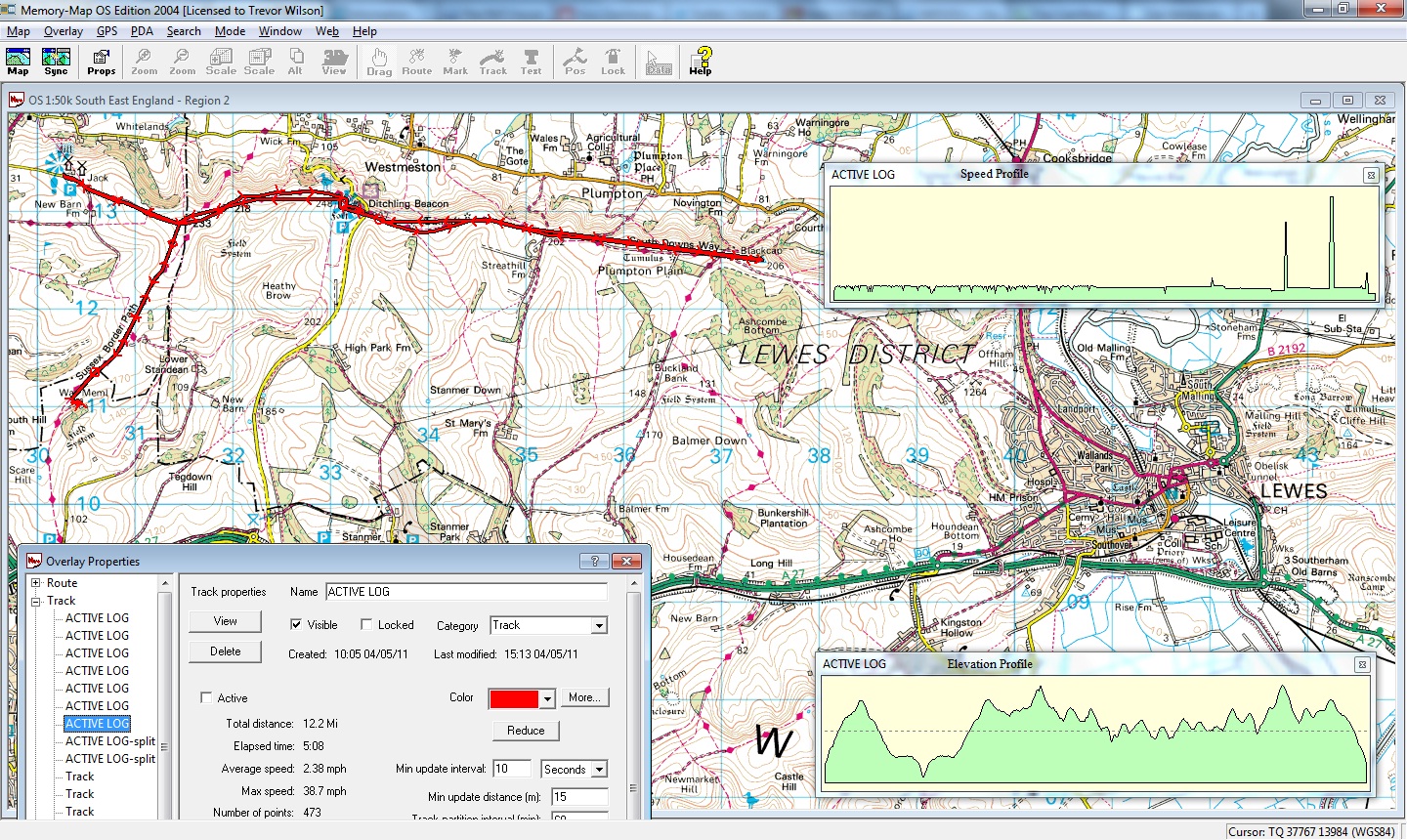
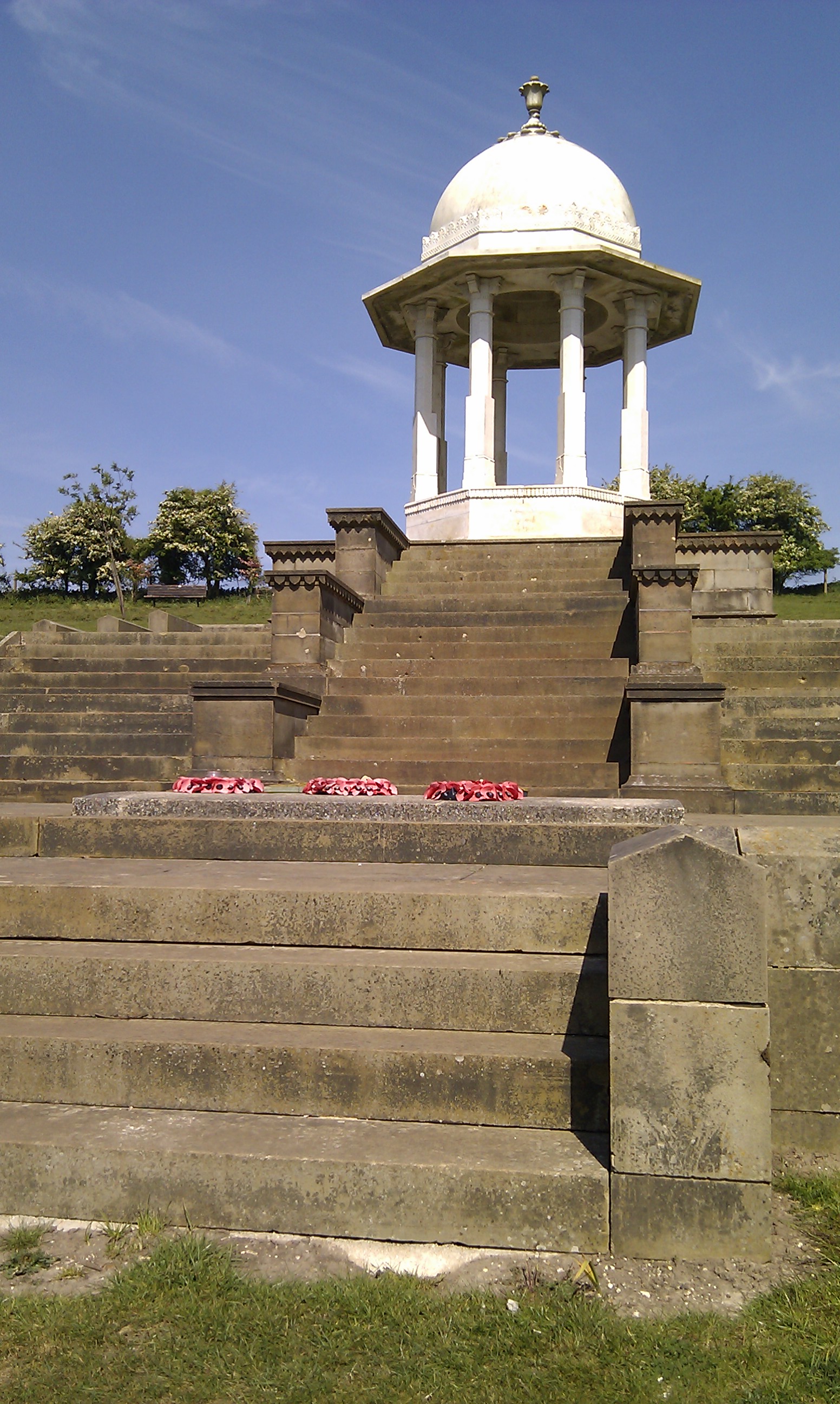
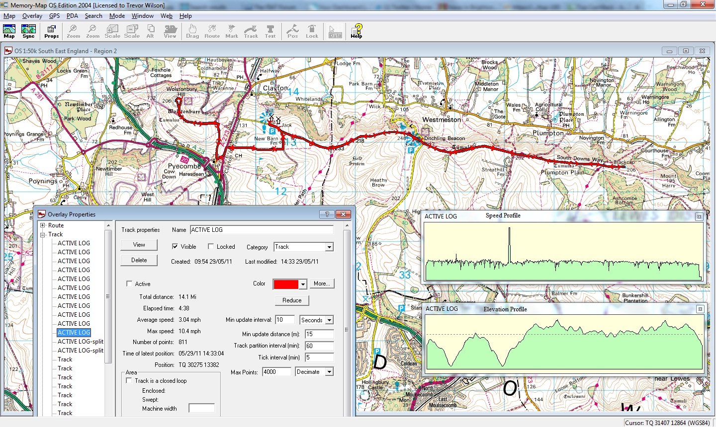
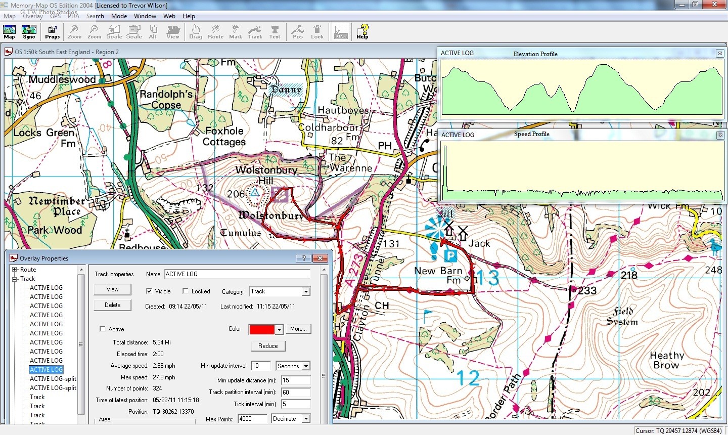
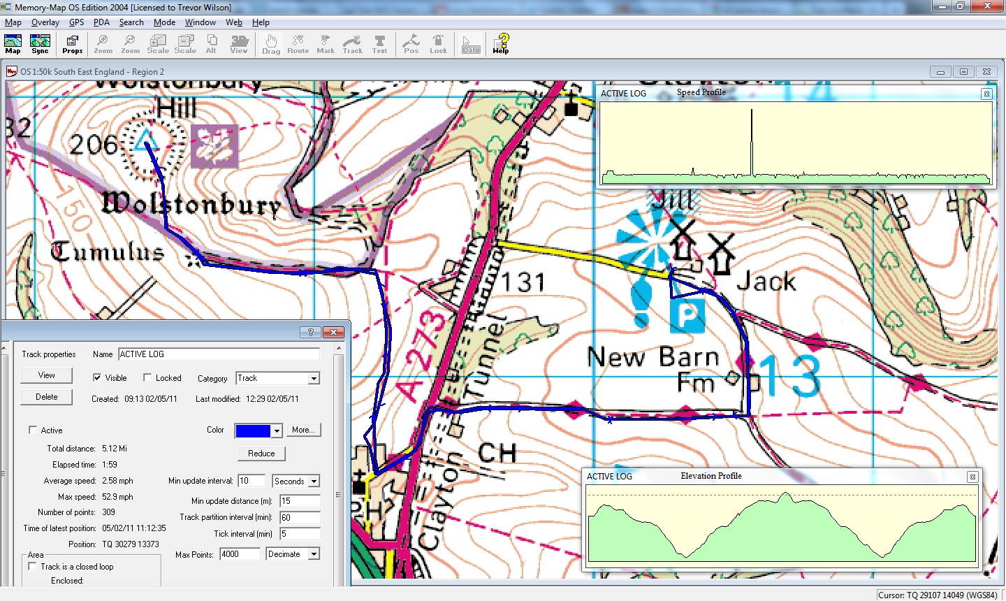
This was a big old walk, starting out from the mills at Clayton, taking the first mile on the Beacon path before heading down to the Chattri.

As is the way from the last fortnight, I’ve been struggling with the breathing during these walks so this one was planned to be a bit more gentle in the beginning – best part of a mile up hill, then 1 1/2 miles down to the Chattri. I was surprised by how out of breath I was doing the climb, clearly I have a congestion issue at present.

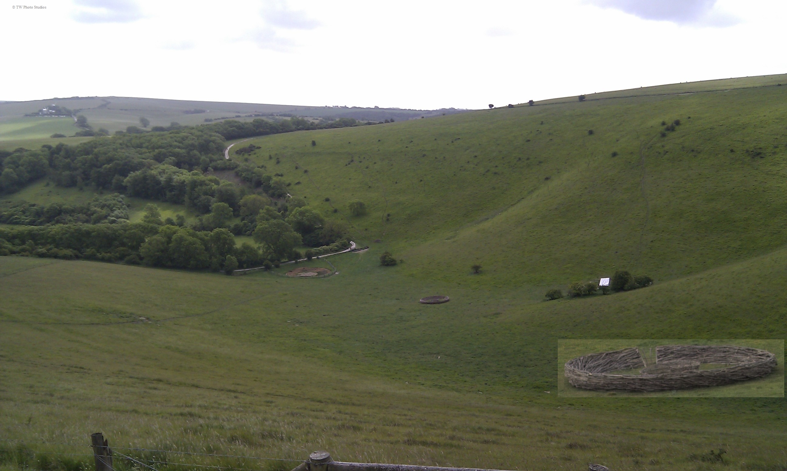
Reached the Chattri, and had a sit down before the walk back to the Beacon path with a pause to wonder what was going on as a Land Rover Discovery stopped in the field and the sheep were positively  running to get there !!!! (I’ll resist the temptation to say that the driver had ‘animal magnetism’:-)

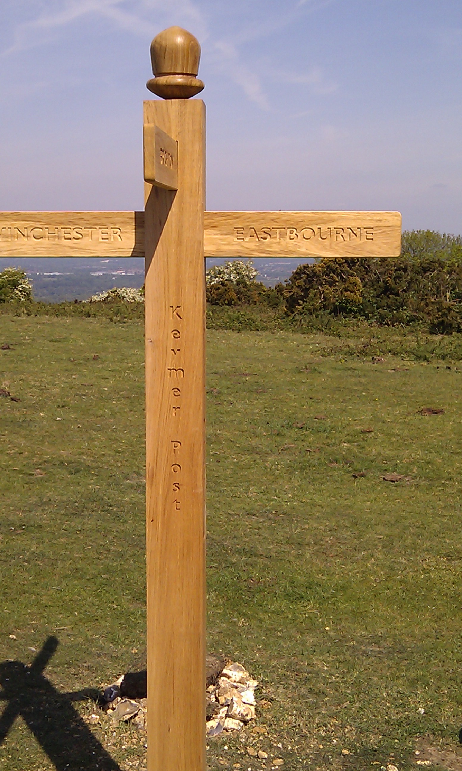
Back at the Beacon path spotted new signpost which indicated Eastbourne and Winchester (there is NO way that I would wander to either of them from there!)

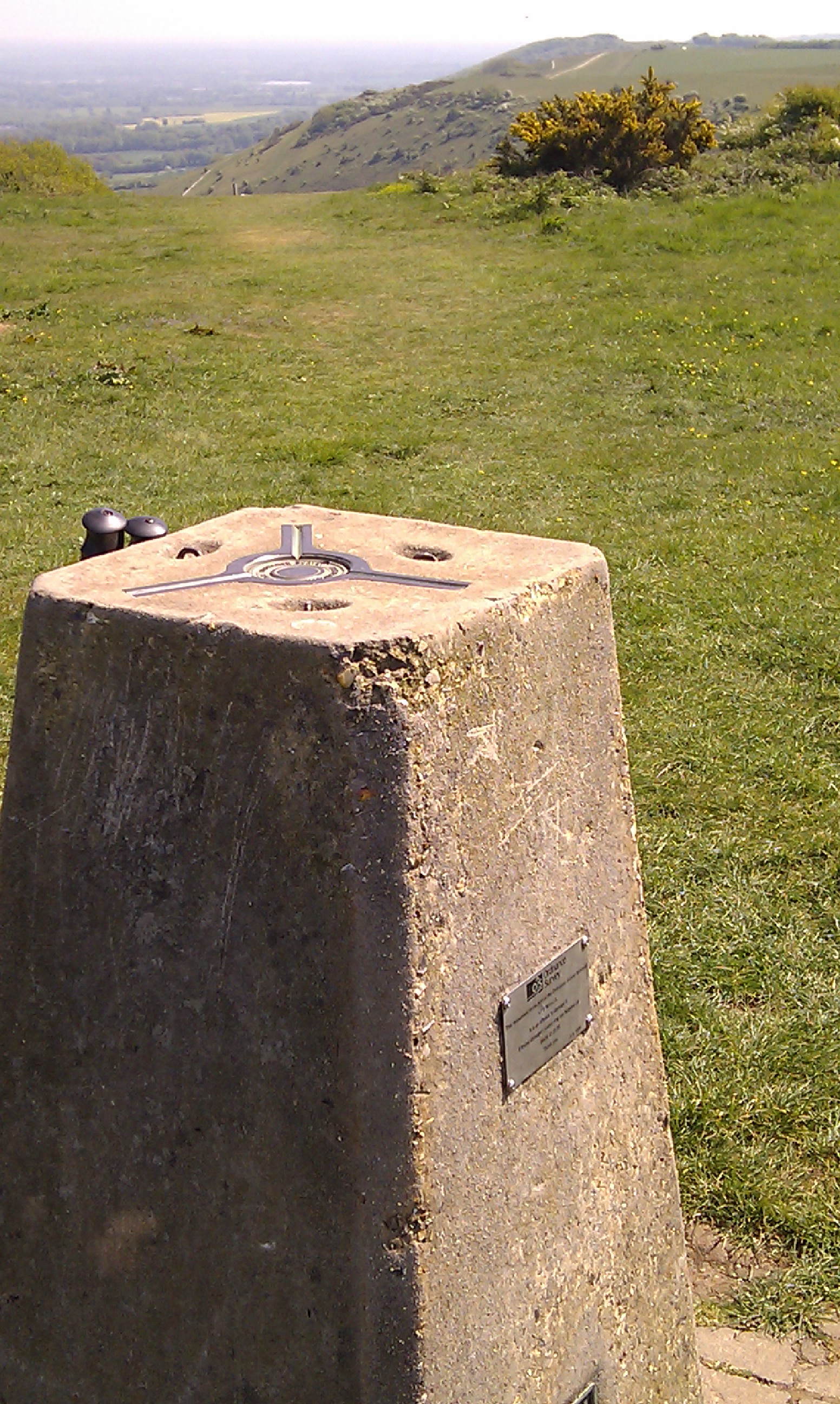
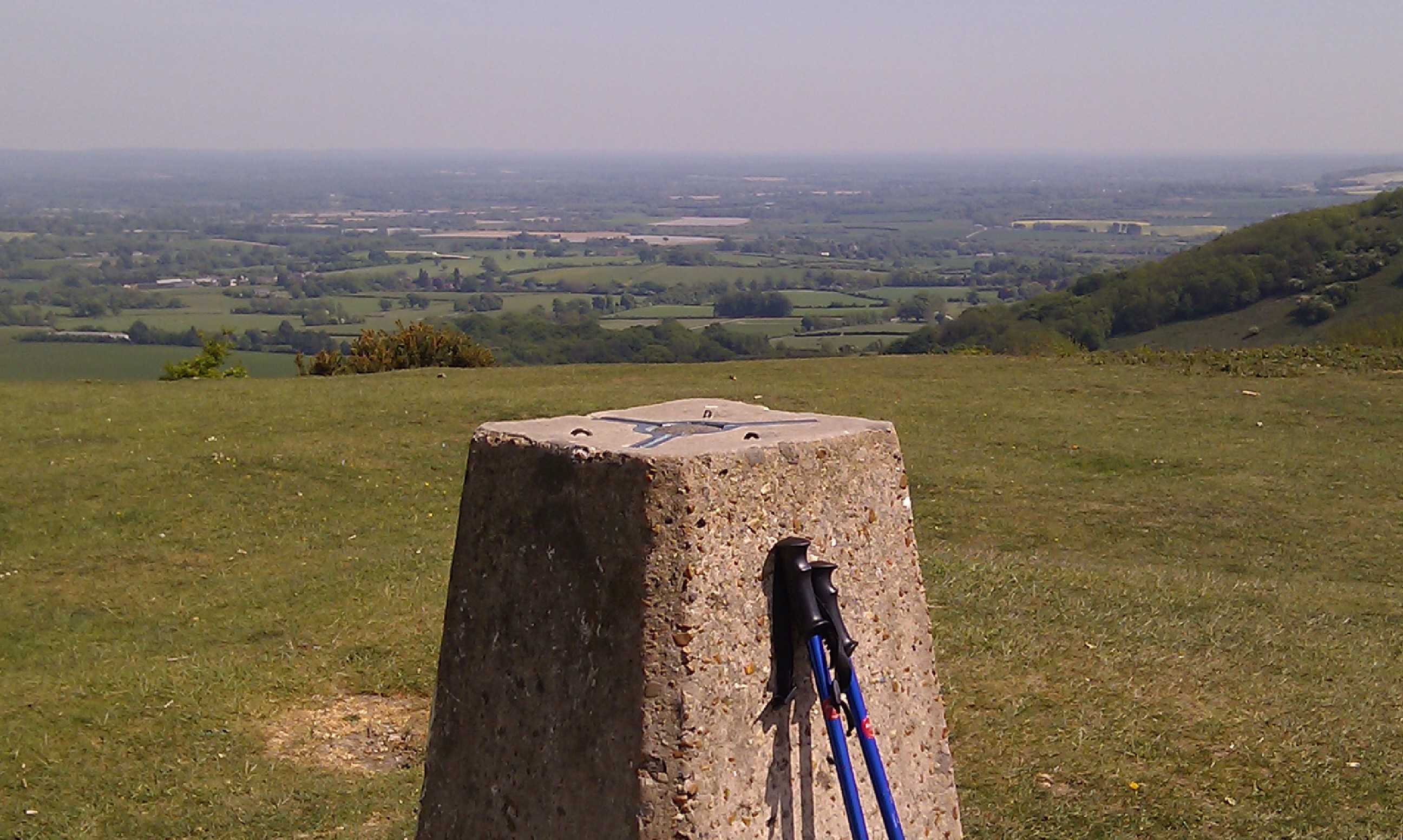
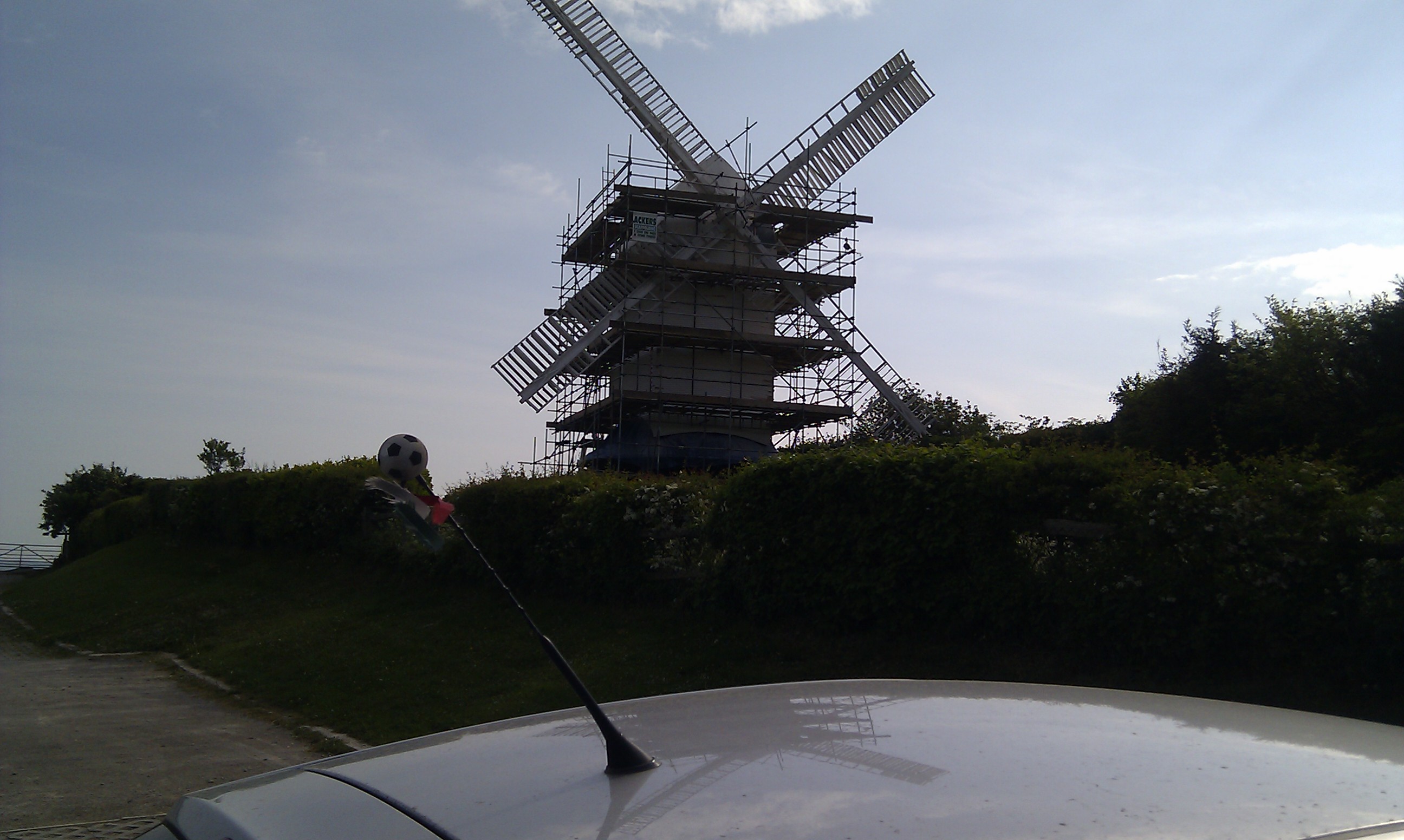
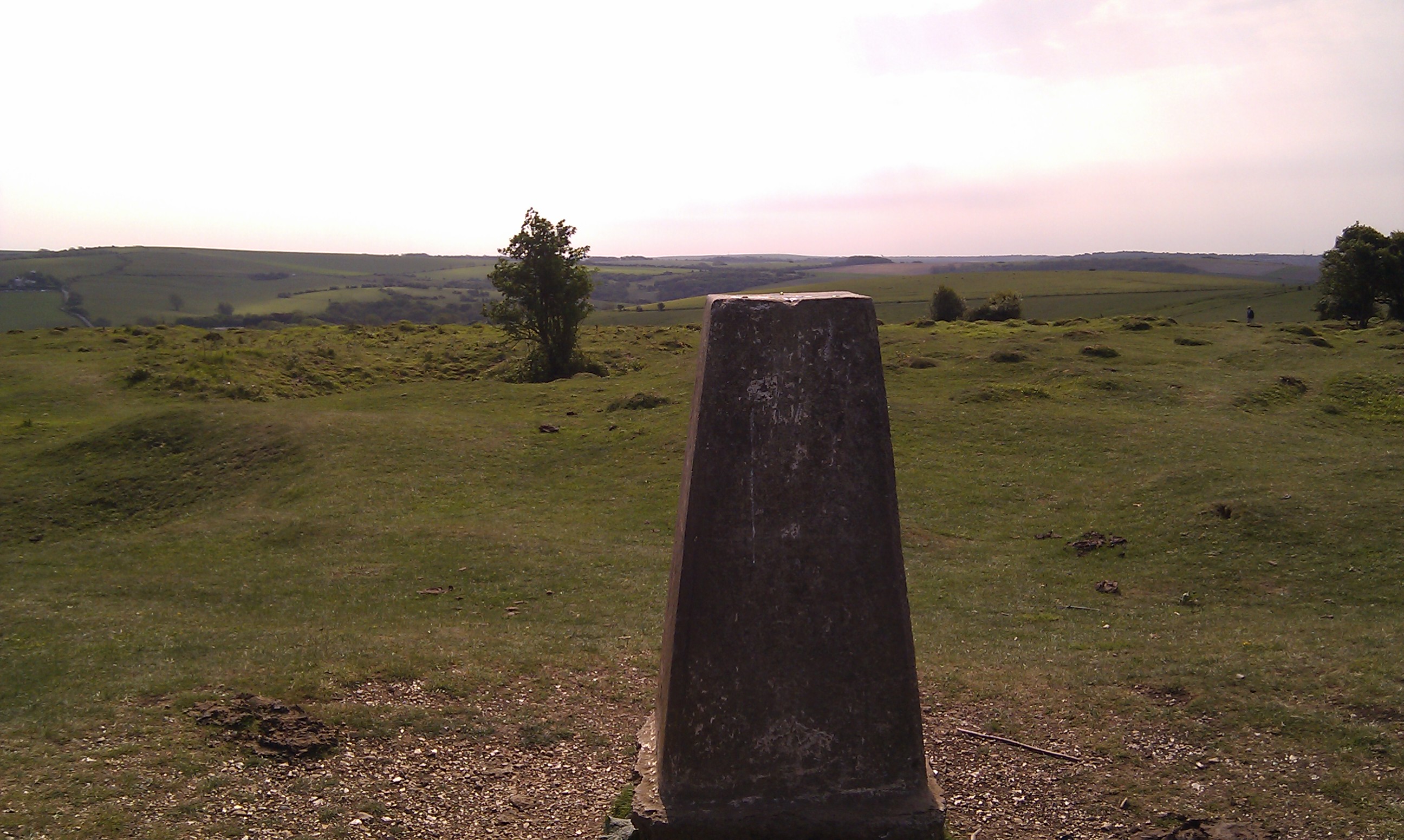
Set off for the Beacon but deviated off to the left to see the other path looking down on Westmeston, but eventually rejoined the main path, and continued on the Trig Point for the Beacon, and the awaiting ice cream van in the car park 🙂 (yep I partook of a cone)

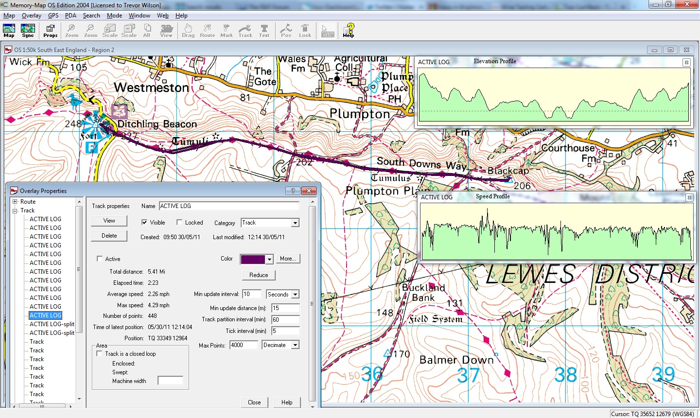
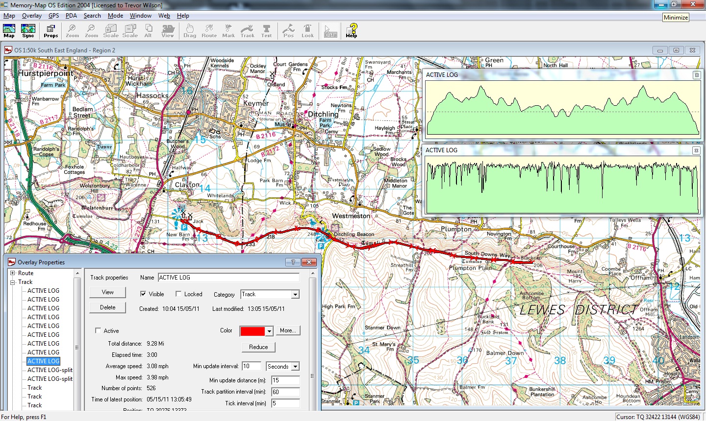
Crossed the Beacon road and set off for Plumpton Plain to discover that the batteries for the GPS were dying, so turned it off to preserve what little life was left – I had plans to record odd points on my way.

Carried on past Street and Plumpton Bostalls (these are lanes) and eventually reached the Trig Point at Black Cap, where I rested for a few minutes, temporarily waking up the GPS to record the farthest reach of this walk.

Set back gently strolling, and resting eventually stopping for a sit down just before crossing the Beacon Road, where I discovered that ruddy Mountain Dew over here is fizzy and I had a fountain not a bottle !

After a good rest, the road was crossed, and the walk was completed, but not before 1 last surprise.

As I descended towards Mill Lane and the car park I could hear a skylark singing, I turned and for the first time ever could see one at rest not 6 foot away.

I quietly continued back to the car firing off the GPS to record the finish before driving home.

Today’s walk in all it’s glory The Chattri

The new signpost

Ditchling Beacon Trig Point

Black Cap Trig Point

02/05/2011 – Wolstonbury Hill

Monday, May 2nd, 2011

Parked up by the windmills at Clayton and set off for Wolstonbury Hill, the intent was to walk up Wolstonbury then return and go to Black Cap via ditchling Beacon to complete a 3 Trig point walk.

However I had to re-appraise the walk as the ascent from Pycombe to Wolstonbury was proving problematical due to shortness of breath and a lack of energy (this was the start for gawd’s sake)!

Taking in some stops for breathers and rests I managed to pass out of the tree lined path and begin walking across the open grassland to the top of the hill and the Trig point (TP) where it became apparent that the wind was blowing very strongly and reaching the TP would not be a problem 🙂

Once at the top I took a picture to prove I had made it before descending back to Pycombe and the main road before the climb by the golf course :-O

As expected the the wind and shortness of breath made the climb heavy going, by the time I reached the stables I had decided that I would return to the car rather than struggle.

So this is a tiny walk of some 5.12 miles, it will be repeated hopefully with the TP at Ditchling Beacon also  reached at a minimum.

Here’s the Map and photos:

The Wolstonbury Hill walkJill undergoing work - the start and end point of some many of my walks.The Trig Point on Wolstonbury Hill